Wright Mountain
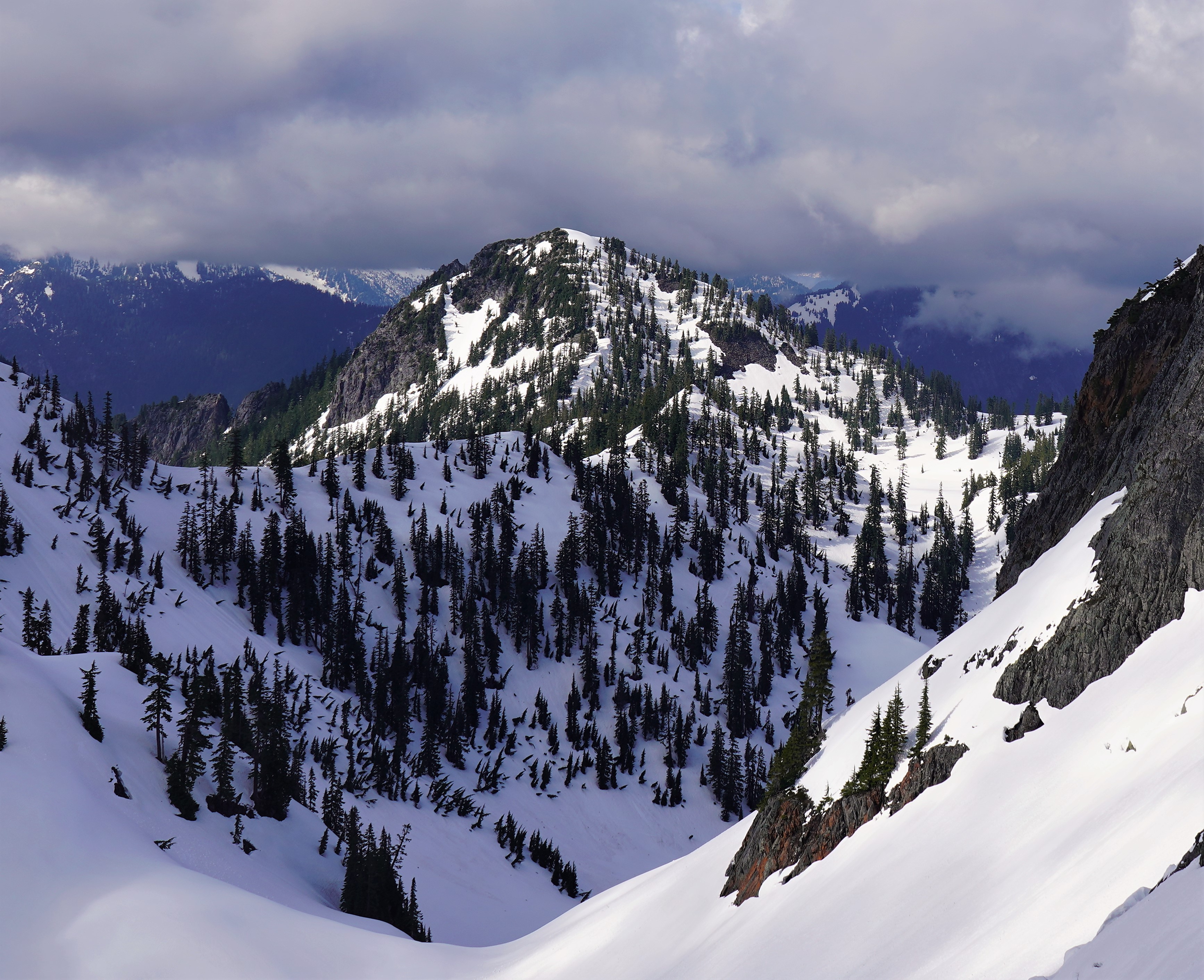
Description
WikipediaWright Mountain is a 5,430-foot-elevation (1,660-meter) mountain summit located 11 mi (18 km) northwest of Snoqualmie Pass, in east King County of Washington state. It is part of the Cascade Range and is situated within the Alpine Lakes Wilderness, on land managed by Mount Baker-Snoqualmie National Forest. Wright Mountain is set above the northern shore of Gem Lake, and less than one mile north-northwest of Snow Lake. Neighbors within two miles include Kaleetan Peak, Chair Peak, and Mount Roosevelt, which is its nearest higher neighbor. Precipitation runoff from the mountain drains into tributaries of the Snoqualmie River. This mountain's name was officially proposed as Mount Wright in 1925 by The Mountaineers, and amended to Wright Mountain in 1968 by the U.S. Board on Geographic Names, to commemorate George E. Wright, a prominent Seattle attorney and mountaineer who was active in establishing Olympic National Park. Wright died October 9, 1923.
Best months
Hiking score 0–100 · 10-yr climate averagesNeighbouring summits
| Name | Elevation | Bearing | Distance |
|---|---|---|---|
| Mount Roosevelt | 1,779 m | SW 212° | 1.3 km |
| Wild Dare | 1,620 m | NW 328° | 2.1 km |
| Kaleetan Peak | 1,908 m | S 202° | 2.1 km |
| Chair Peak | 1,902 m | S 178° | 2.3 km |
| Caroline Peak | 1,795 m | W 273° | 2.7 km |
| Avalanche Mountain | 1,634 m | SE 113° | 3.0 km |
Climbing routes
nearest first| Route | Area | Grade | From summit |
|---|---|---|---|
| Northeast Buttress | Winter-Spring (ice, snow, mixed) | 3+ | 2.3 km |
| Chair-Bryant Traverse | Summer-Fall (rock) | 5a | 2.3 km |
| Northwest Ridge | Summer-Fall (rock) | 5a | 2.3 km |
| East Face | Summer-Fall (rock) | 3 | 2.3 km |
| Judgement Day | Alpental Clever | 5a | 3.9 km |
| Tooth - Chair Traverse | Summer-Fall (rock) | 4a | 3.9 km |
| The Tooth Fairy | Summer-Fall (rock) | 5c | 3.9 km |
| Southwest Face | Summer-Fall (rock) | 4b | 3.9 km |
| East Face | Summer-Fall (rock) | 5b | 3.9 km |
| South Face | Summer-Fall (rock) | 4a | 3.9 km |
| East Face Variation | Winter-Spring (ice, snow, mixed) | 5b | 3.9 km |
| Northeast Slabs | Winter-Spring (ice, snow, mixed) | 1+ | 3.9 km |
| New York Gully | Snoqualmie Mountain | 5b | 4.4 km |
| South Face | Lundin Peak | 1+ | 5.4 km |
| West Ridge | Lundin Peak | 1+ | 5.4 km |
| South Face (2001 Variation) | Lundin Peak | 6b | 5.4 km |
| Traverse | Osprey Wall | 4a | 6.0 km |
| Prey | Osprey Wall | 6b | 6.0 km |
| Salish | Osprey Wall | 4c | 6.0 km |
| Improbable Traverse | Summer-Fall (rock) | 5b | 6.1 km |
| South Gully/South Spur | Summer-Fall (rock) | 1+ | 6.1 km |
| South Rib | Summer-Fall (rock) | 1 | 6.1 km |
| Blood Sport | Summer-Fall (rock) | 6c | 6.1 km |
| East Ridge | Red Mountain | 1+ | 6.5 km |
| Ragged Ridge | Red Mountain | 5.5 | 6.5 km |