Record SL-669622 · Wikidata Q98079155
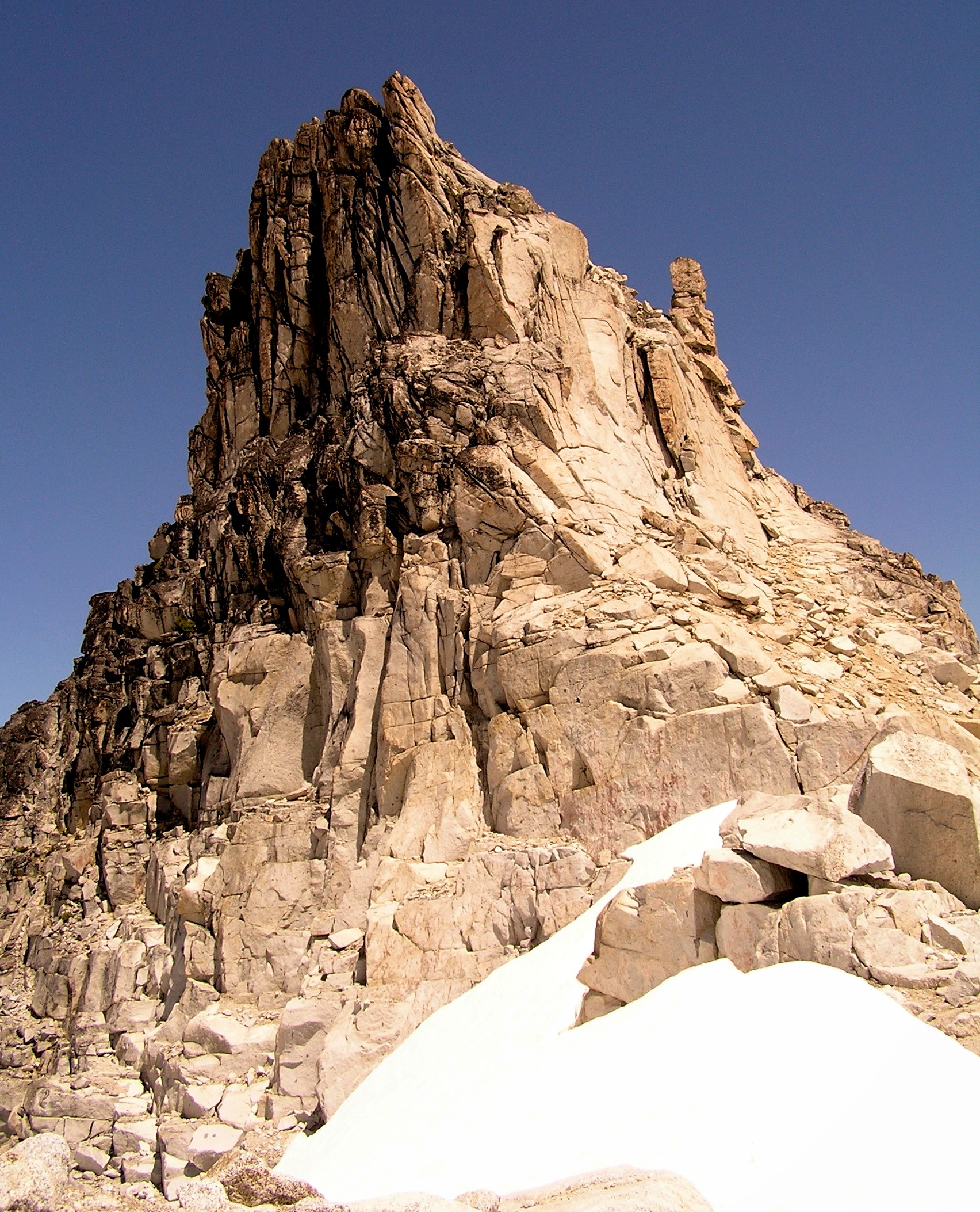
Witches Tower
No list classifications
Elevation
2,597
m
8,520 ft
Prominence
64 m
Isolation
0.6 km
Coordinates
47.4767° N,
120.8254° W
Grid ref
—
Description
WikipediaWitches Tower is an 8,566-foot (2,611-metre) granite summit located 10 mi (16 km) southwest of Leavenworth in Chelan County of Washington state. Witches Tower is part of The Enchantments within the Alpine Lakes Wilderness, and is set on land managed by the Okanogan–Wenatchee National Forest. It belongs to the Stuart Range which is subset of the Wenatchee Mountains. Witches Tower is situated 0.8 mi (1.3 km) northwest of Little Annapurna, and 0.4 mi (0.64 km) east-southeast of Dragontail Peak, which is its nearest higher neighbor. Witches Tower is surrounded by remnants of Snow Creek Glacier. Precipitation runoff drains into tributaries of the Wenatchee River.
Best months
Hiking score 0–100 · 10-yr climate averagesRows beneath each bar: mean temperature, monthly precipitation. Highest-scoring month in red.
Neighbouring summits
| Name | Elevation | Bearing | Distance |
|---|---|---|---|
| Dragontail Peak | 2,695 m | NW 295° | 0.6 km |
| West Annapurna | 2,537 m | SE 139° | 0.7 km |
| Pandora's Box | 2,658 m | W 265° | 0.8 km |
| Little Annapurna | 2,578 m | SE 140° | 1.3 km |
| Pennant Peak | 2,463 m | SE 145° | 1.5 km |
| Colchuck Peak | 2,653 m | W 276° | 1.6 km |
Climbing routes
nearest first| Route | Area | Grade | From summit |
|---|---|---|---|
| E/SE Face | Witches Tower | 1 | 20 m |
| Heartbroken | Split Personality Boulder | V4- | 536 m |
| Gerber-Sink | Dragontail Peak | 5a | 639 m |
| Serpentine Arete | Dragontail Peak | 5b | 639 m |
| Dragons of Eden | Dragontail Peak | 7a+ | 639 m |
| This, My Friend | Dragontail Peak | 5c | 639 m |
| Der Dihedral | Dragontail Peak | 5c | 639 m |
| Backbone Ridge | Dragontail Peak | 5c | 639 m |
| Acid Baby | Aasgard Sentinel | 6b+ | 824 m |
| The Valkyrie | Aasgard Sentinel | 6b | 824 m |
| East Face | Jaberwocky Tower | 4c | 1.6 km |
| Northeast Buttress | Colchuck Peak | 5b | 1.6 km |
| Colchuck Glacier | Colchuck Peak | 1- | 1.6 km |
| The Tipping Point | Colchuck Balanced Rock | 7b+ | 1.8 km |
| West Face | Colchuck Balanced Rock | 7a | 1.8 km |
| The Balanced Rock | Colchuck Balanced Rock | — | 1.8 km |
| Colchuck Balanced Rock Col (East Lake Side Approch) | Colchuck Balanced Rock | 1- | 1.8 km |
| Scarface | Colchuck Balanced Rock | 6b+ | 1.8 km |
| NW Ridge | Colchuck Balanced Rock | 5.6 | 1.8 km |
| The Scoop | Colchuck Balanced Rock | 6c+ | 1.8 km |
| Let it Burn | Colchuck Balanced Rock | 7a+ | 1.8 km |
| Full Tilt (Tempest Wall Free Version) | Colchuck Balanced Rock | 7b+ | 1.8 km |
| The Tempest | Colchuck Balanced Rock | 7c | 1.8 km |
| Milk n' Honey | Colchuck Balanced Rock | 6c | 1.8 km |
| Rikki Tikki Tavi | Colchuck Balanced Rock | 6c+ | 1.8 km |