Mount Cruiser
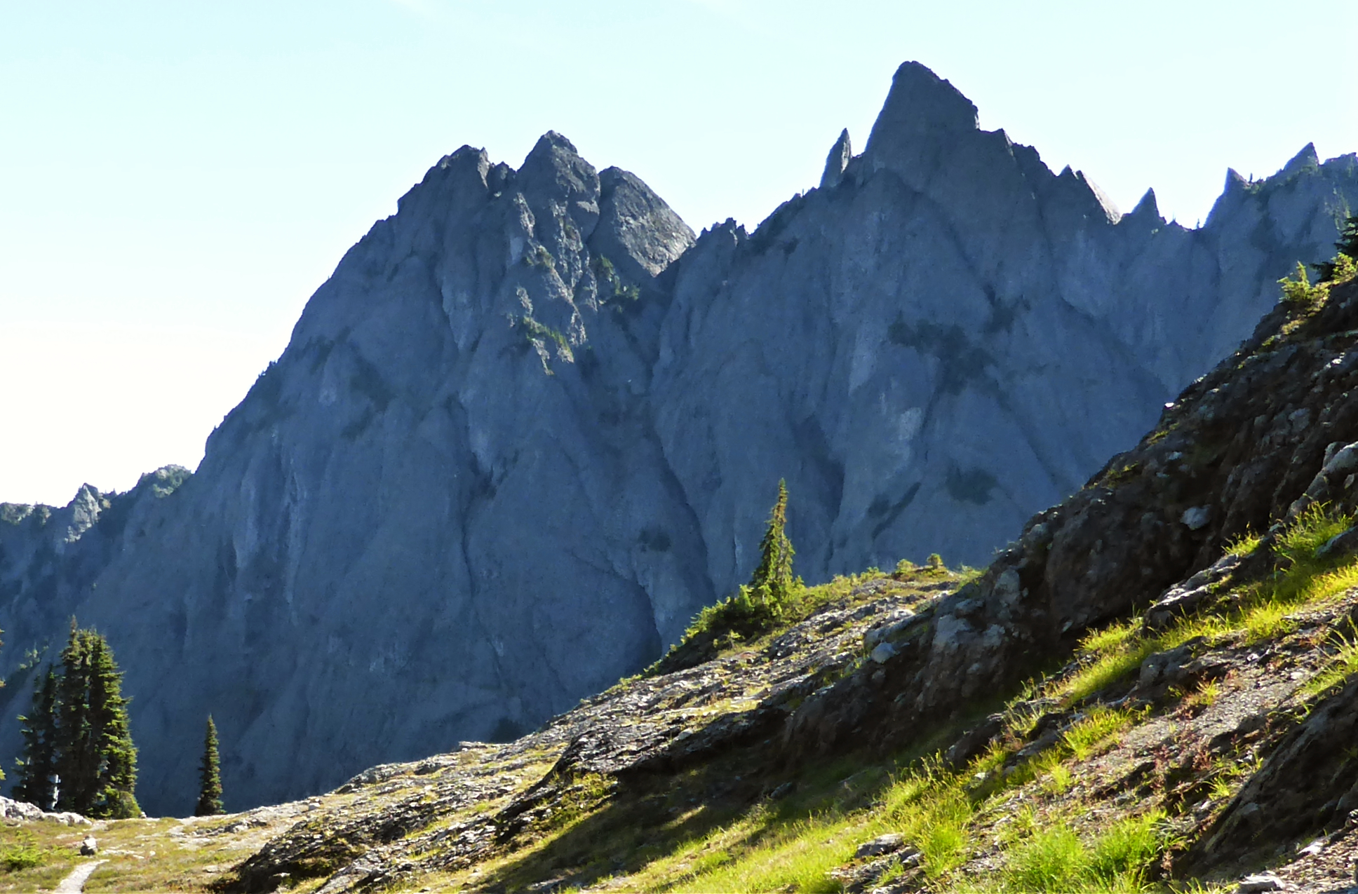
Description
WikipediaMount Cruiser is a 6,104-foot-elevation (1,860-meter) mountain summit located in the Olympic Mountains, in Mason County of Washington state, United States. It is situated in Mount Skokomish Wilderness on land managed by Olympic National Forest. Cruiser is the highest point on Sawtooth Ridge, and its nearest higher peak is Mount Skokomish, 2.1 mi (3.4 km) to the north-northeast. Cruiser has two sub-peaks, Alpha (6,040 ft; 1,841 m), and Beta (5,920 ft; 1,804 m), the latter of which lies on the Olympic National Park boundary. The first ascent of the peak was made in 1937 by Paul Crews and Ray Layton. The mountain was named by the first ascent party to recognize their club, the Bremerton Ski Cruisers. The mountain's toponym was officially adopted in 1961 by the United States Board on Geographic Names. Precipitation runoff from the mountain drains into the Hamma Hamma River.
First ascent
Best months
Hiking score 0–100 · 10-yr climate averagesNeighbouring summits
| Name | Elevation | Bearing | Distance |
|---|---|---|---|
| Mount Gladys | 1,695 m | NW 304° | 0.9 km |
| Mount Lincoln | 1,760 m | SW 210° | 1.8 km |
| Mount Henderson | 1,830 m | N 5° | 2.5 km |
| Mount Skokomish | 1,961 m | NE 29° | 3.4 km |
| Cub Peak | 1,450 m | SE 150° | 3.4 km |
| Mount Pershing | 1,876 m | E 107° | 4.7 km |
Climbing routes
nearest first| Route | Area | Grade | From summit |
|---|---|---|---|
| South Corner | Mt. Cruiser | 3+ | 15 m |
| Washington Ellinor Traverse (Ridge) | Mt. Washington | 1+ | 6.4 km |
| SE Ridge AKA Shield Wall | Mt. Washington | 5a | 6.4 km |
| School rock | Open book | 5b | 8.1 km |
| The open book | Open book | 6b+ | 8.1 km |
| After school special | Open book | 5a | 8.1 km |
| The back page | Open book | 6c | 8.1 km |
| Dangling participle | Open book | 6b+ | 8.1 km |
| The preface | Open book | 5b | 8.1 km |
| Hats off to the People | Sphinx Rock | 5c | 8.2 km |
| X Rock | X Rock | 6c | 8.2 km |
| Diagonal crack | X Rock | 4c | 8.2 km |
| Lockdown | X Rock | 5c | 8.2 km |
| Sa da tay | X Rock | 5b | 8.2 km |
| Mcleary memorial route | Plaque wall | 6c | 8.2 km |
| Totally Cush | Plaque wall | 6a+ | 8.2 km |
| Lichen the Moss | Reclamation wall | 6b | 8.2 km |
| Reclamation Project | Reclamation wall | 5b | 8.2 km |
| Stempy | Reclamation wall | 5b | 8.2 km |
| Moss Scrubber | Reclamation wall | 5b | 8.2 km |
| That’s a Salad | Reclamation wall | 6b+ | 8.2 km |
| For the Love of Zinc | Reclamation wall | 5c | 8.2 km |
| Original Route | Reclamation wall | 5a | 8.2 km |
| Bacon Bits | Reclamation wall | 6b+ | 8.2 km |
| Climbers Don’t Play Jenga | Reclamation wall | 5b | 8.2 km |