Record SL-667471 · Wikidata Q49034938
Harding Mountain
No list classifications
Elevation
2,186
m
7,172 ft
Prominence
382 m
Isolation
4.8 km
Coordinates
47.5276° N,
120.9859° W
Grid ref
—
Description
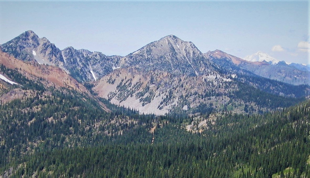
WikipediaHarding Mountain is a 7,173 ft (2,190 m) mountain summit located in Chelan County of Washington state. It is the seventh-highest point in the North Wenatchee Mountains. Harding Mountain is situated within the Alpine Lakes Wilderness, 5.35 mi (8.61 km) northwest of Mount Stuart, and 4.1 mi (6.6 km) west of Eightmile Mountain, on land managed by Wenatchee National Forest. Precipitation runoff from the peak drains into tributaries of Icicle Creek, which in turn is a tributary of the Wenatchee River. This mountain was named after President Warren G. Harding by Albert Hale Sylvester.
Best months
Hiking score 0–100 · 10-yr climate averagesRows beneath each bar: mean temperature, monthly precipitation. Highest-scoring month in red.
Neighbouring summits
| Name | Elevation | Bearing | Distance |
|---|---|---|---|
| Solomon Mountain | 2,163 m | SW 217° | 1.3 km |
| Scatter Peaks | 2,143 m | S 194° | 2.7 km |
| Tucquala Peak | 2,079 m | W 282° | 4.2 km |
| Highchair Mountain | 2,138 m | N 353° | 4.5 km |
Climbing routes
nearest first| Route | Area | Grade | From summit |
|---|---|---|---|
| East Ridge | Ingalls Peak | 5a | 6.8 km |
| South Ridge | Ingalls Peak | 4a | 6.8 km |
| My Daily Shame | Lake Ingalls Outcrop | 6a | 7.6 km |
| Got your nuts | Lake Ingalls Outcrop | 5a | 7.6 km |
| More Fun Than I Thought | Headlight Playground | 3 | 8.2 km |
| The Direct North Ridge w/ Gendarme | Mt Stuart | 5c | 8.4 km |
| Gorillas Direct | Mt Stuart | 6b+ | 8.4 km |
| Girth Pillar | Mt Stuart | 6c | 8.4 km |
| Cascadian Couloir | Mt Stuart | 1- | 8.4 km |
| Sherpa Glacier | Mt Stuart | 1 | 8.4 km |
| King Kong - Gorillas Direct Direct | Mt Stuart | 7a | 8.4 km |
| Stuart Glacier Couloir | Mt Stuart | 5.7 | 8.4 km |
| Gorillas in the Mist | Mt Stuart | 6c | 8.4 km |
| South Headwall | Mt Stuart | 5a | 8.4 km |
| Upper North Ridge w/Great Gendarme | Mt Stuart | 5c | 8.4 km |
| West Ridge | Mt Stuart | 4c | 8.4 km |
| North Ridge | Sherpa Peak | 5b | 9.6 km |
| West Ridge | Sherpa Peak | 4a | 9.6 km |