Mount Agassiz
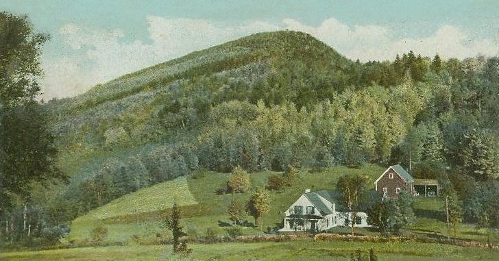
Description
WikipediaMount Agassiz is a peak in the White Mountains of New Hampshire with an elevation of 2,378 feet (725 m). It is located in the town of Bethlehem in Grafton County. Originally named Peaked Hill, it is named in honor of Louis Agassiz. An observation tower was built at the summit by 1877, and an auto road was opened circa 1932. Prior to construction of the auto road, an automobile first reached the summit in 1926, via a carriage road, due to a misunderstanding by the driver. A ski trail was cut in 1936–37, with a rope tow added three seasons later; the rope tow operated into the 1980s. In the mid-1950s, the auto road was rebuilt and a snack bar was added at the summit area. Plans during the early 1960s to greatly expand the ski area, including construction of a monorail, never materialized. The property is privately owned; the current owner does not prohibit hikers.
Best months
Hiking score 0–100 · 10-yr climate averagesNeighbouring summits
| Name | Elevation | Bearing | Distance |
|---|---|---|---|
| Cleveland Mountain | 715 m | SE 150° | 1.0 km |
| Lewis Hill | 613 m | W 256° | 1.2 km |
| Abbot Hill | 525 m | SE 143° | 3.5 km |
| Garnet Mountain | 650 m | SW 246° | 3.5 km |
| Priest Hill | 591 m | SE 157° | 4.6 km |
Climbing routes
nearest first| Route | Area | Grade | From summit |
|---|---|---|---|
| Arachnid | Governator, The | V1 | 9.3 km |
| Double Bluff | Artist's Bluff Boulder | V0 | 9.6 km |
| The Paintbrush | Artist's Bluff Boulder | V0- | 9.6 km |
| Caligraphy | Split Boulder | V1-2 | 9.6 km |
| Handy Cap Direct | Artist's Bluff | 7a+ | 9.6 km |
| Standard Route 5.10 variation | Artist's Bluff | 6a | 9.6 km |
| Artist's Arete (mid-cliff Start) | Artist's Bluff | 4c | 9.6 km |
| Standard route 5.7 variation | Artist's Bluff | 5a | 9.6 km |
| Gawking Peepers | Artist's Bluff | 6c+ | 9.6 km |
| Brass Balls | Artist's Bluff | 5b | 9.6 km |
| Right Side Route | Artist's Bluff | 4c | 9.6 km |
| Special Olympics | Artist's Bluff | 6b | 9.6 km |
| Little Monalisa | Artist's Bluff | 4a | 9.6 km |
| Standard Route | Artist's Bluff | 4b | 9.6 km |
| Vincent's Ear | Artist's Bluff | 6b | 9.6 km |
| Standard Direct | Artist's Bluff | 4c | 9.6 km |
| Rembrandt with a Grenade | Trench Boulder | V3 | 9.6 km |
| Anna's Treat | 1. Square Inch Wall | 7a | 9.8 km |
| Beeline | 1. Square Inch Wall | 5a | 9.8 km |
| Queen Weetamoo | 1. Square Inch Wall | 5b | 9.8 km |
| Sackless | 1. Square Inch Wall | 5b | 9.8 km |
| Finger Locking Good | 1. Square Inch Wall | 5c | 9.8 km |
| Piss of Fear | 1. Square Inch Wall | 6a | 9.8 km |
| Mean Clean Climb | 1. Square Inch Wall | 6b+ | 9.8 km |
| Barking up the Wrong Tree | 1. Square Inch Wall | 4c | 9.8 km |