Record SL-821498 · Wikidata Q49061081
Picture Puzzle
No list classifications
Elevation
4,048
m
13,281 ft
Prominence
—
Isolation
1.8 km
Coordinates
37.1279° N,
118.5388° W
Grid ref
—
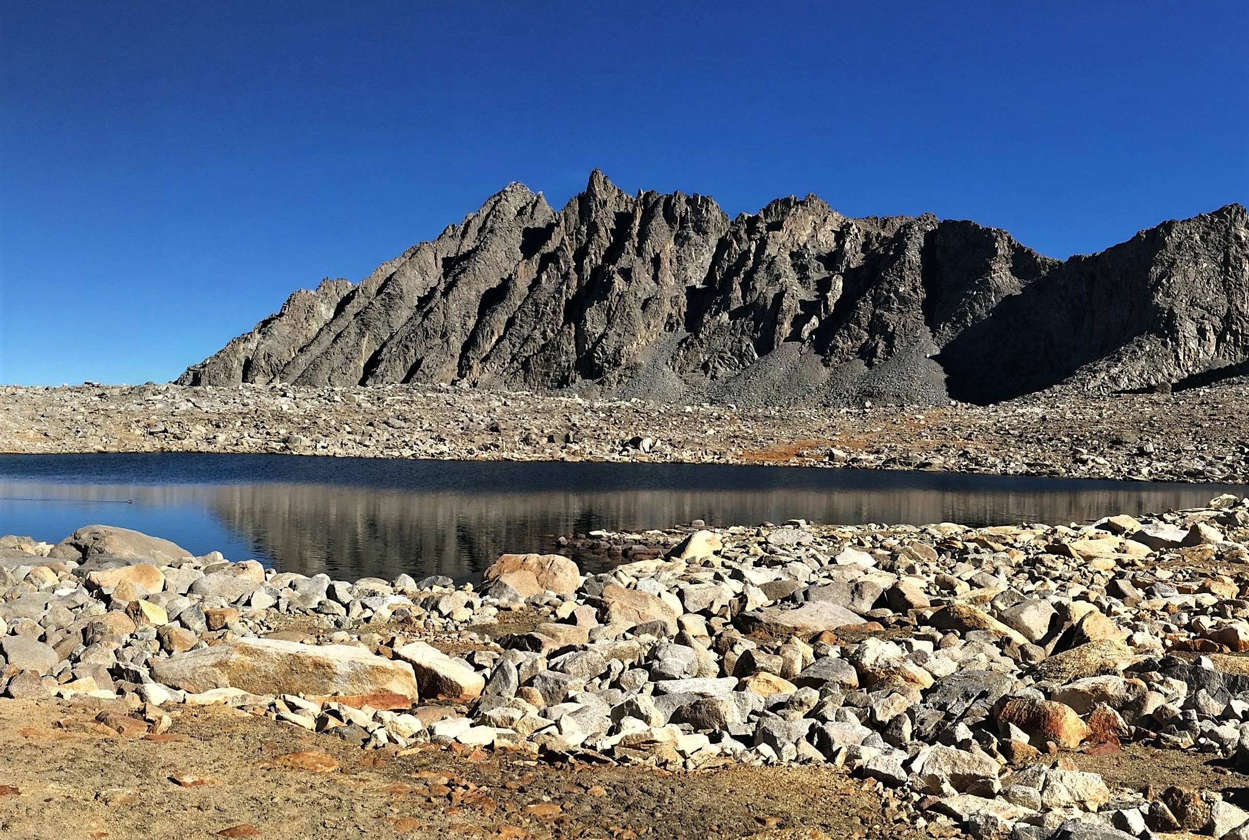
Description
WikipediaPicture Puzzle, also known as Picture Puzzle Peak, is a 13,297-foot-elevation (4,053-meter) mountain summit located one mile east of the crest of the Sierra Nevada mountain range in Inyo County of northern California, United States. It is situated in the Palisades area of the John Muir Wilderness, on land managed by Inyo National Forest. It is approximately 14.5 miles (23.3 km) west of the community of Big Pine, one mile north of Bishop Pass, 0.8 miles (1.3 km) northwest of Aperture Peak, 1.2 miles (1.9 km) north-northwest of Mount Agassiz, and 1.1 miles (1.8 km) south-southwest of parent Cloudripper. Picture Puzzle ranks as the 90th-highest summit in California, and the third-highest peak of the Inconsolable Range.
First ascent
Date
1937
Norman Clyde
Source · wikipedia
Best months
Hiking score 0–100 · 10-yr climate averagesRows beneath each bar: mean temperature, monthly precipitation. Highest-scoring month in red.
Neighbouring summits
| Name | Elevation | Bearing | Distance |
|---|---|---|---|
| Gendarme Peak | 4,039 m | E 103° | 0.7 km |
| Aperture Peak | 4,043 m | SE 146° | 1.3 km |
| Two Eagle Peak | 3,956 m | E 82° | 1.4 km |
| Cloudripper | 4,122 m | NE 24° | 1.8 km |
| Mount Agassiz | 4,235 m | S 158° | 1.9 km |
| Chocolate Peak | 3,561 m | NW 333° | 2.2 km |
Climbing routes
nearest first| Route | Area | Grade | From summit |
|---|---|---|---|
| The Diamond | Two Eagle Peak | 4c | 1.5 km |
| West Chute | Cloudripper | 1- | 1.8 km |
| North Slope | Cloudripper | 1- | 1.8 km |
| East Ridge | Cloudripper | 1- | 1.8 km |
| Inconsolable Traverse | Cloudripper | 4c | 1.8 km |
| North Slope | Vagabond Peak (aka Thunder and Lightning Peak) | 1- | 2.5 km |
| North Buttress | Mt. Goode | 5c | 2.6 km |
| Sky Pilot | Mt. Goode | 6c+ | 2.6 km |
| North Buttress Variation. | Mt. Goode | 7a | 2.6 km |
| West Ridge of Mt Goode | Mt. Goode | 4a | 2.6 km |
| No Goode | Mt. Goode | 4a | 2.6 km |
| Goode Adventure | Mt. Goode | 6c+ | 2.6 km |
| South East Slope | Mt. Goode | 1- | 2.6 km |
| Jonny B. Goode | Mt. Goode | 6a+ | 2.6 km |
| Goode Earth | Mt. Goode | 6a+ | 2.6 km |
| Northeast Ridge, Traverse from Hurd Peak | Peak 12,192 | 1+ | 2.8 km |
| Northwest Ridge | Peak 12,192 | 1- | 2.8 km |
| East Arete | Mt. Winchell | 1- | 2.8 km |
| Southwest Chute | Mt. Winchell | 4c | 2.8 km |
| McKenzie's Arete | Mt. Winchell | 6b | 2.8 km |
| West Arete | Mt. Winchell | 5b | 2.8 km |
| North Ridge | Hurd Peak | 5a | 2.9 km |
| South Lake Peaks Traverse | Hurd Peak | 1+ | 2.9 km |
| Northeast Arete | Hurd Peak | 4b | 2.9 km |
| Don't Be a Square | Trapezoid Peak | 6a | 3.3 km |