Parker Peak
Description
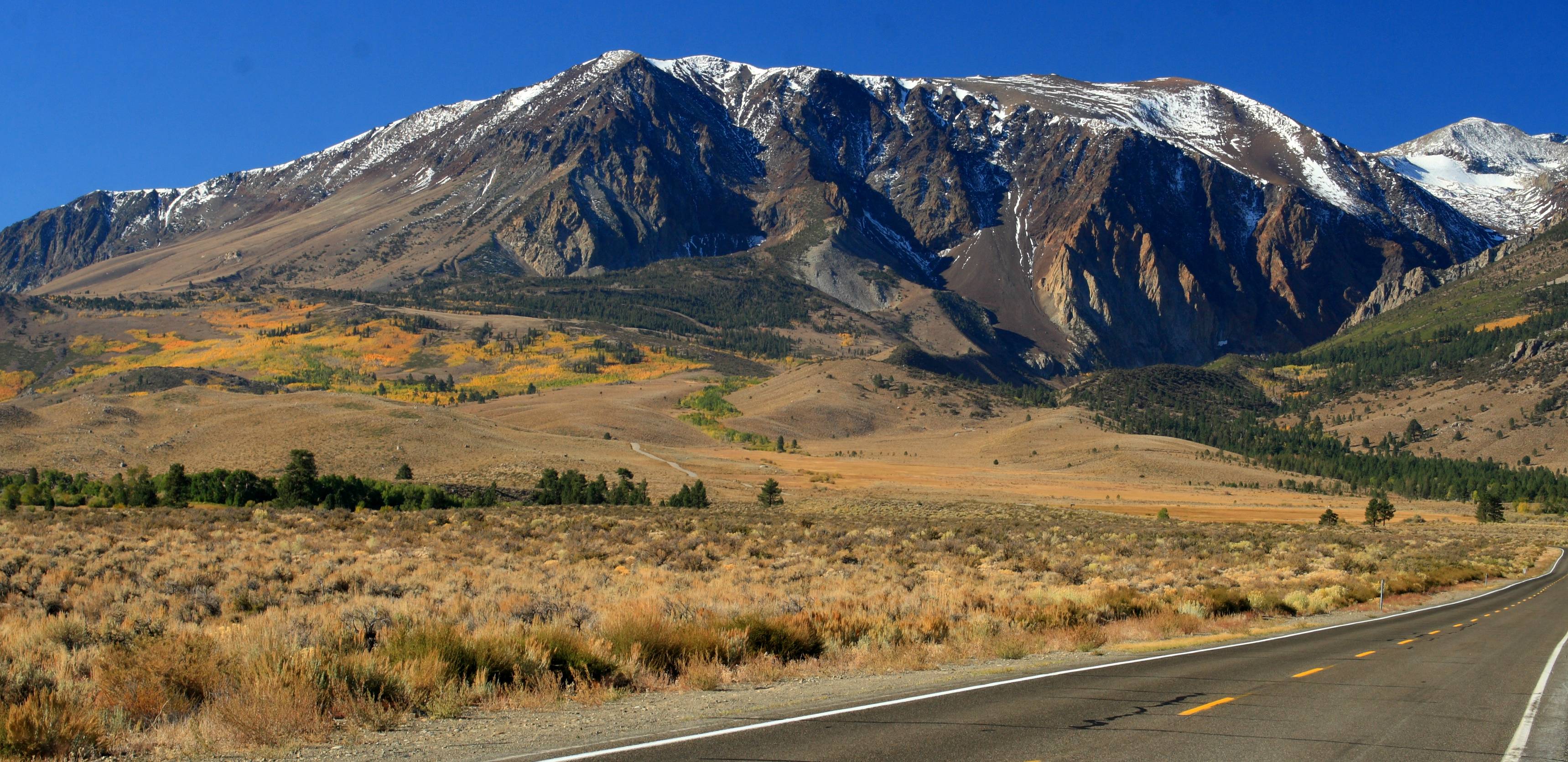
WikipediaParker Peak is a 12,861-foot-elevation (3,920-meter) mountain summit located in the Sierra Nevada mountain range, in Mono County of northern California, United States. It is situated in the Ansel Adams Wilderness, on land managed by Inyo National Forest. It is approximately 7.0 miles (11.3 km) northwest of the community of June Lake, 1.2 miles (1.9 km) east of Yosemite National Park's eastern boundary, and 1.0 mile (1.6 km) east of Koip Peak, the nearest higher neighbor. The mountain is visible from the June Lake Loop, and from the nearby June Mountain ski area. Topographic relief is significant as it rises over 5,700 feet (1,700 meters) above Grant Lake in four miles. This geographical feature's name has been officially adopted by the U.S. Board on Geographic Names. The first ascent of the summit was made in 1914 by Norman Clyde.
First ascent
Best months
Hiking score 0–100 · 10-yr climate averagesNeighbouring summits
| Name | Elevation | Bearing | Distance |
|---|---|---|---|
| Koip Peak | 3,954 m | W 268° | 1.6 km |
| Mount Wood | 3,858 m | E 108° | 1.7 km |
| Kuna Peak | 3,958 m | W 266° | 2.1 km |
| Blacktop Peak | 3,881 m | SW 205° | 2.5 km |
| Mount Lewis | 3,765 m | N 351° | 3.2 km |
| Mount Andrea Lawrence | 3,730 m | SW 220° | 4.9 km |
Climbing routes
nearest first| Route | Area | Grade | From summit |
|---|---|---|---|
| Plata o Plomo | Family Wall | 6c | 6.5 km |
| Five Nine D | Family Wall | 6a | 6.5 km |
| While You Were Sleeping | Family Wall | 5b | 6.5 km |
| While You Were Quarantining | Family Wall | 5a | 6.5 km |
| Visit to the Gunks | 9-Secor | 4c | 6.6 km |
| Connect Secor to Moynier | 9-Secor | 5b | 6.6 km |
| Center Face | 9-Secor | 5a | 6.6 km |
| Center Crack | 9-Secor | 4b | 6.6 km |
| Right Flake | 9-Secor | 4c | 6.6 km |
| Connect Low | 9-Secor | 4b | 6.6 km |
| Left Arete + Crack | 9-Secor | 4a | 6.6 km |
| Hammerbruch | 9-Secor | 4a | 6.6 km |
| Left Ridge | 9-Secor | 5a | 6.6 km |
| Left Slab | 9-Secor | 4b | 6.6 km |
| Blocks to Ridge | 8-Moynier | 5b | 6.6 km |
| Left Center Low Face | 8-Moynier | 5a | 6.6 km |
| Left Low Face | 8-Moynier | 3+ | 6.6 km |
| Right Low Chimney | 8-Moynier | 4c | 6.6 km |
| NorthEast ridge Right side | 8-Moynier | 5a | 6.6 km |
| NorthEast ridge Direct | 8-Moynier | 5b | 6.6 km |
| Left High Face | 8-Moynier | 5a | 6.6 km |
| Right High Face | 8-Moynier | 4c | 6.6 km |
| Center High Face | 8-Moynier | 4c | 6.6 km |
| Mamba | 8-Moynier | 4c | 6.6 km |
| Remix | 8-Moynier | 5a | 6.6 km |