Mount Pickering
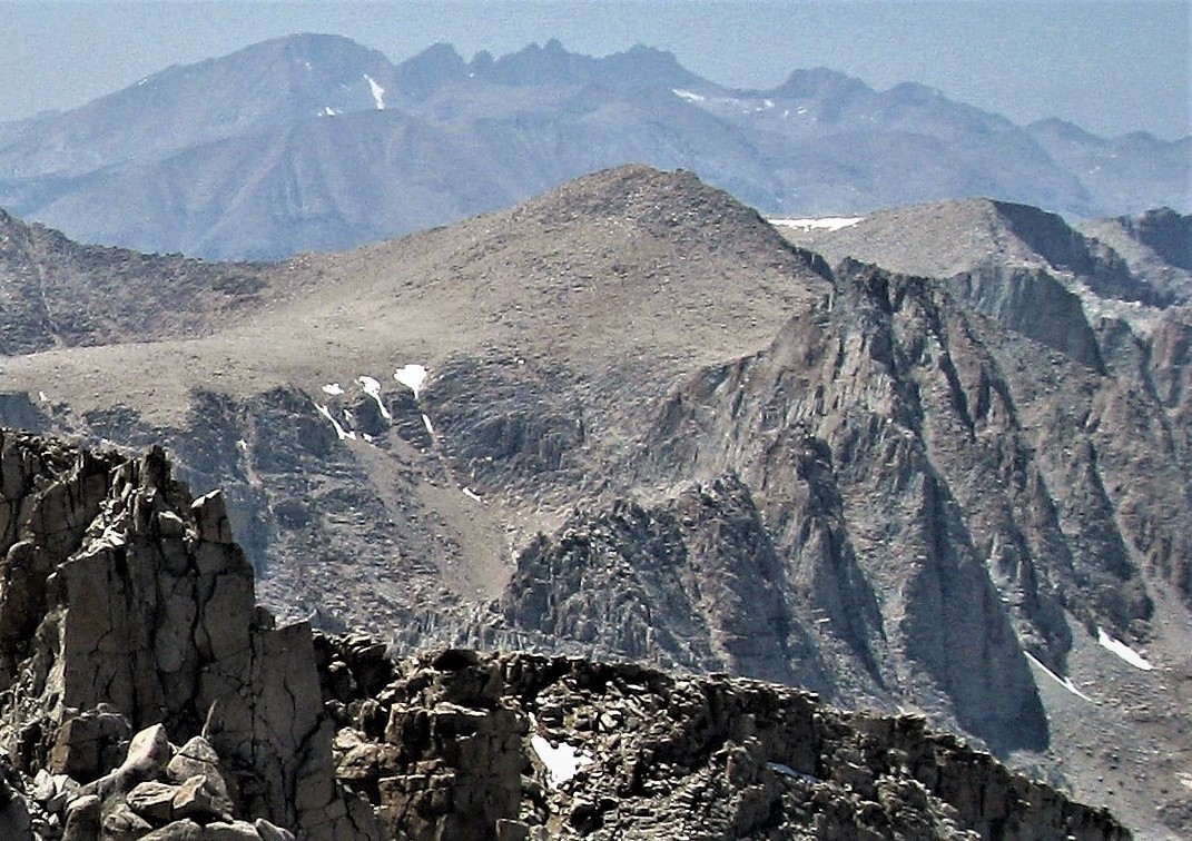
Description
WikipediaMount Pickering is a 13,474-foot-elevation (4,107-meter) mountain summit located just west of the crest of the Sierra Nevada mountain range in Tulare County, California. It is situated in Sequoia National Park, and is 3.1 miles (5.0 km) south of Mount Whitney, 1.2 miles (1.9 km) southeast of Mount Chamberlin, and one mile south of Mount Newcomb. Mt. Pickering ranks as the 65th highest summit in California. Topographic relief is significant as it rises nearly 2,000 feet above Sky Blue Lake in approximately one mile. This mountain's name was proposed by the Sierra Club and officially adopted in 1940 by the U.S. Board on Geographic Names to honor American astronomer Edward Charles Pickering (1846–1919). The immediate area has other geographical features named for astronomers, including Mount Newcomb, Mount Langley, Mount Young, and Mount Hale. The first ascent of the summit was made July 16, 1936, by Chester Versteeg, Tyler Van Degrift, and Oliver Kehrlein.
First ascent
Best months
Hiking score 0–100 · 10-yr climate averagesNeighbouring summits
| Name | Elevation | Bearing | Distance |
|---|---|---|---|
| Joe Devel Peak | 4,063 m | S 201° | 1.4 km |
| Mount Newcomb | 4,090 m | N 351° | 1.4 km |
| Mount Chamberlin | 4,011 m | W 292° | 1.9 km |
| The Miter | 3,892 m | E 70° | 2.5 km |
| Mount McAdie | 4,206 m | NE 26° | 3.0 km |
| Mount Marsh | 4,118 m | N 21° | 3.3 km |
Climbing routes
nearest first| Route | Area | Grade | From summit |
|---|---|---|---|
| Asleep at the Wheel | Mt. Chamberlin | 7a+ | 2.1 km |
| The Sword in the Stone | Mt. Chamberlin | 6c | 2.1 km |
| Safety First | Mt. Chamberlin | 6b+ | 2.1 km |
| East Buttress | Mt. Irvine | 5c | 4.0 km |
| Welcome to Krackizstan | Mt. Hitchcock | 6b+ | 4.0 km |
| Pressure Drop | Mt. Hitchcock | 6c+ | 4.0 km |
| The Starlight Dihedral | Mt. Hitchcock | 6c+ | 4.0 km |
| From the John Muir Trail | Mt. Muir | 1- | 4.2 km |
| East Buttress (w/ variations) | Mt. Muir | 5a | 4.2 km |
| From Trail by W + N ridge | Mt. Muir | 4c | 4.2 km |
| North east couloir | Mt. Langley | 1- | 4.7 km |
| Rest & Be Thankful (aka North Arete) | Mt. Langley | 6a | 4.7 km |
| East Face | Aiguille Junior (pk 14000+) | 5b | 4.7 km |
| East Face | Aiguille Extra | 6a | 5.0 km |
| Pinnacle Pass - South side | Pinnacle Ridge | 1- | 5.2 km |
| Pinnacle Pass - North side | Pinnacle Ridge | 1+ | 5.2 km |
| Traverse of Pinnacle Ridge | Pinnacle Ridge | 4a | 5.2 km |
| WNW Edge | Day Needle (aka Crooks Peak) | 1 | 5.3 km |
| Beckey-Reese East Face Direct | Day Needle (aka Crooks Peak) | 6b | 5.3 km |
| WNW Edge | Keeler Needle | 1- | 5.4 km |
| Blood of the Monkey | Keeler Needle | 7b+ | 5.4 km |
| Harding Route | Keeler Needle | 6b+ | 5.4 km |
| Red Baron Tower | Peak 3986 | 6b | 5.5 km |
| Milktoast Chimney | Peak 3986 | 5b | 5.5 km |
| SouthWest Edge | Mt. Whitney | 4b | 5.7 km |