Skip to content
SUMMITLOG
Start a log
North America / United States / California / Mount Cotter
Record SL-818535 · Wikidata Q6920265

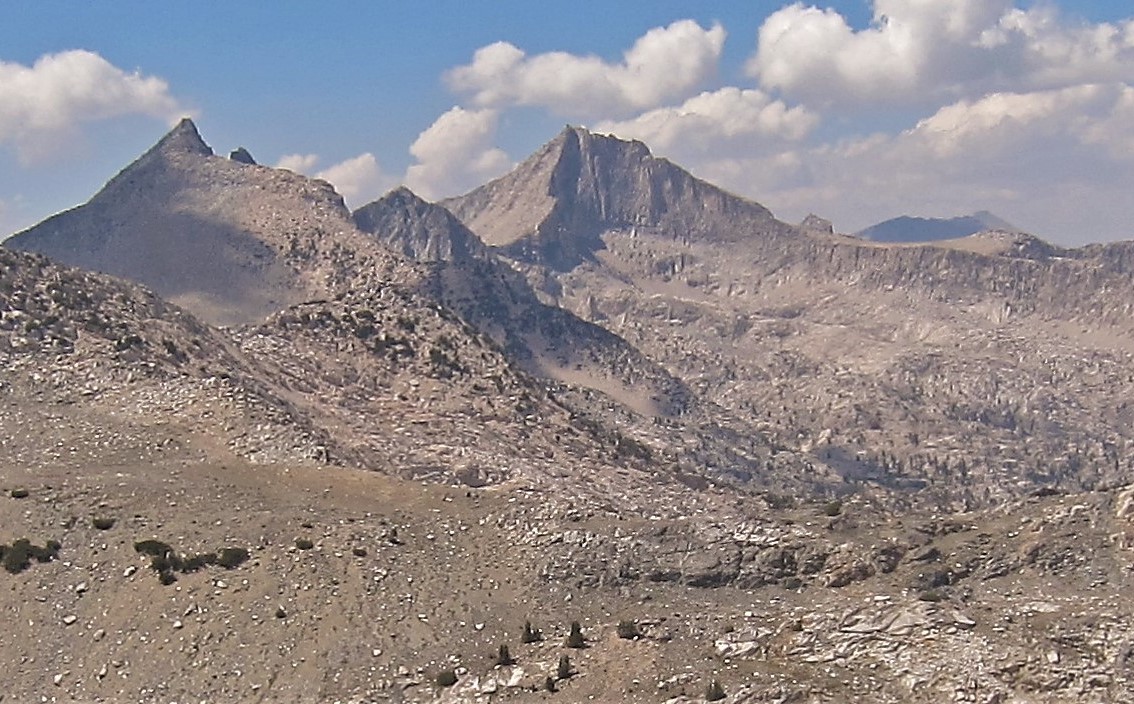
Mount Cotter

No list classifications
Elevation
3,879 m
12,727 ft
Prominence
542 m
Isolation
Coordinates
36.8190° N, 118.4419° W
Grid ref
Mount Cotter
Mount CotterWikimedia Commons

Description

Wikipedia

Mount Cotter, located in the Kings Canyon National Park, is named for Dick Cotter who was a packer with the California Geological Survey in 1864. Cotter and Clarence King made the first ascent of Mount Tyndall. The Mountain has an elevation of 12,719 feet (3,877 m). The mountain is easily climbed from Gardiner Basin with a class 2-3 slope. There are more difficult routes found on the north and east sides of Mount Cotter. The mountain features a large class 4-5 summit block. Mount Cotter can be reached from the west or east side of the Sierra Nevada. Wilderness permits are required for overnight stays entering from either the east or west. There is a Visitors Center in Grant Grove that can inform visitors of when the office at Road's End will be open. Camping is allowed in many places along the approach to Mt Cotter. Kearsarge Lakes, Charlotte Lake, and Rae Lakes all have a maximum 2 nights stay, and Bullfrog Lake along the Kearsarge Pass Trail is closed to camping. Bear canisters are required for overnight stays.

First ascent

Date
1922
Bob Fitzsimons
Source · wikipedia

Best months

Rows beneath each bar: mean temperature, monthly precipitation. Highest-scoring month in red.
Neighbouring summits

Name Elevation Bearing Distance
Mount Clarence King 3,932 m N 346° 1.7 km
Mount Gardiner 3,935 m SW 227° 2.1 km
Fin Dome 3,546 m E 103° 2.7 km
Glacier Spike 3,803 m SE 138° 4.6 km
Diamond Peak 4,004 m E 80° 4.7 km
Painted Lady 3,688 m SE 127° 4.8 km

Climbing routes

nearest first
Route Area Grade From summit
Northeast Buttress Mount Cotter 4a 34 m
East Ridge Indirect Mt. Clarence King 5a 1.6 km
East Face - Ramp Route Mt. Clarence King 5b 1.6 km
North East Ridge (full) Mt. Clarence King 5a 1.6 km
The Golden Bear Tower - Polemonium Mt. Gardiner 6a 2.3 km
South Slope to Southeast Ridge Mt. Gardiner 1 2.3 km
North Arete of the Painted Lady Painted Lady 6a 4.8 km
The Epic-cureans Charlotte Dome 5a 5.3 km
South Face Charlotte Dome 5b 5.3 km
South West Arete Charlotte Dome 5b 5.3 km
Samurai Warrior - Ronan Bubbs Creek Wall 7a+ 6.0 km
The Emperor Bubbs Creek Wall 7a+ 6.0 km
What's Up Bubb? Bubbs Creek Wall 7b 6.0 km
Ikigai Bubbs Creek Wall 7a+ 6.0 km
South Ridge via South Chute Dragon Peak 1- 6.5 km
Southeast Arete Castle Dome 6a 7.0 km
Madirjian's Banana Castle Dome 4a 7.0 km
South Ridge Mt. Gould 1- 7.2 km
East Face - Right Mt. Gould 1- 7.2 km
Direct East Face Nameless Pyramid 6b 8.5 km