Skip to content
SUMMITLOG
Start a log
North America / United States / Arizona / Sunnyslope Mountain
Record SL-633127 · Wikidata Q14680738

Sunnyslope Mountain

'''S Mountain'''
No list classifications
Elevation
460 m
1,509 ft
Prominence
Isolation
Coordinates
33.5744° N, 112.0766° W
Grid ref
Sunnyslope Mountain
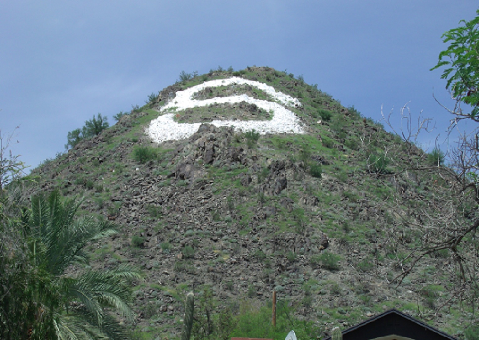
Sunnyslope MountainWikimedia Commons

Description

Wikipedia

Sunnyslope Mountain also known as "S" Mountain is a large, rocky, nearly symmetric hill in the Sunnyslope section of Phoenix, Arizona. It is located near Central Avenue and Hatcher Road. The southern slope of the mountain is adorned with a 150-foot white majuscule "S". The mountain, in particular the large "S", can be seen from thirty miles away on a clear day, and is distinctly visible to nearby airplane passengers. Although the mountain is part of the Phoenix Mountains, the mountain is most closely associated with Sunnyslope High School. Each year, the freshmen class is assigned the task of hiking up the mountain and giving the "S" a fresh coat of white paint. At the end of the Homecoming football game, the "S" is traditionally outlined with red flares which are ignited by members of the freshmen football team. Students came together in June 2004 to convert the "S" to a "J" in memory of Josh Conard, a basketball player for Sunnyslope who was killed by a drunk driver. When the school was remodeled in the mid-1990s, the view of Sunnyslope Mountain from the home football stands was partially obstructed. However, Sunnyslope Mountain remains one of the most visible, artificial features of the northern skyline of the Valley of the Sun. The name of the mountain is derived from the bordering Sunnyslope district of Phoenix. Sunnyslope is generally defined as the area east and south of North Mountain and north of the Arizona Canal. It is listed on the Phoenix Historic Property Register.
Best months

Rows beneath each bar: mean temperature, monthly precipitation. Highest-scoring month in red.

Neighbouring summits

Name Elevation Bearing Distance
North Mountain 628 m N 18° 1.3 km
Shaw Butte 650 m NW 337° 2.4 km
Moon Hill 507 m N 346° 4.4 km

Climbing routes

nearest first
Route Area Grade From summit
The Gnome Lookout Mountain 6a 6.0 km
Falling Stars Lookout Mountain 7a 6.0 km
Unknown Lookout Mountain 5c 6.0 km
Loose Lieback Lookout Mountain 5b 6.0 km
To Loose To Goose Lookout Mountain 6b 6.0 km
Totally Trad Lookout Mountain 5b 6.0 km
Speed Freak Lookout Mountain 6c+ 6.0 km
Pushin' Your Luck Lookout Mountain 5c 6.0 km
Double Feature Lookout Mountain 6b+ 6.0 km
The Contender Lookout Mountain 6c 6.0 km
Devil in Disguise Lookout Mountain 6a+ 6.0 km
Unknown Lookout Mountain 5a 6.0 km
The Florito Family Stairway Left ASU main campus V1-2 7.8 km
Rhythm and Blues North summit area 6a 7.8 km
Compute This ASU main campus V7-8 7.8 km
Armstrong Hall ASU main campus V1- 7.8 km
The Florito Family Stairway Right ASU main campus V3-4 7.8 km
Math Chimney ASU main campus 5b 7.8 km
P.E.ness ASU main campus V3 7.8 km
Stairwell Cracks ASU main campus V0+ 7.8 km
Engineering Disaster ASU main campus V1 7.8 km
Biodesignical ASU main campus V-easy 7.8 km
The Florito Family Stairway, variation ASU main campus V6-7 7.8 km
Superman ASU main campus V3-4 7.8 km
Pocket Rocket ASU main campus V4 7.8 km