Record SL-688921 · Wikidata Q7196307
P 6800
Ultra
Elevation
6,800
m
22,310 ft
Prominence
470 m
Isolation
—
Coordinates
34.0288° N,
76.0817° E
Grid ref
—
Description
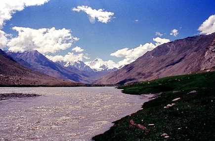
WikipediaThe Pinnacle Peak is a part and third highest summit with elevation 22,740 ft (6,930 metres) of the Nun Kun mountain massif of the western Himalayan Range, located near the Suru valley, on Kargil Zanskar road 80 kilometers west of Kargil town. The Pinnacle Peak is located north-east of Nun 23,409 ft (7,135 metres) which is the highest summit of the massif and is separated from it by a snowy plateau of 4 km in length, between them rises another peak Kun 23,219 ft (7,077 metres).
First ascent
Date
1906
Fanny Bullock Workman
Source · wikipedia
Best months
Hiking score 0–100 · 10-yr climate averagesRows beneath each bar: mean temperature, monthly precipitation. Highest-scoring month in red.
Neighbouring summits
| Name | Elevation | Bearing | Distance |
|---|---|---|---|
| Lingsarmo | 6,930 m | S 192° | 0.8 km |
| Rungofarka | 6,485 m | NE 65° | 1.2 km |
| Amaiur | 5,760 m | NE 41° | 2.7 km |
| Kun | 7,077 m | SW 234° | 2.8 km |