Record SL-436339 · Wikidata Q6947844 · DOBIH 2290
Mynydd Carn-y-cefn
HuMP
TuMP
Dewey
Marilyn
Elevation
550
m
1,804 ft
Prominence
176 m
Isolation
—
Coordinates
51.7692° N,
3.1793° W
Grid ref
SO187084
Description
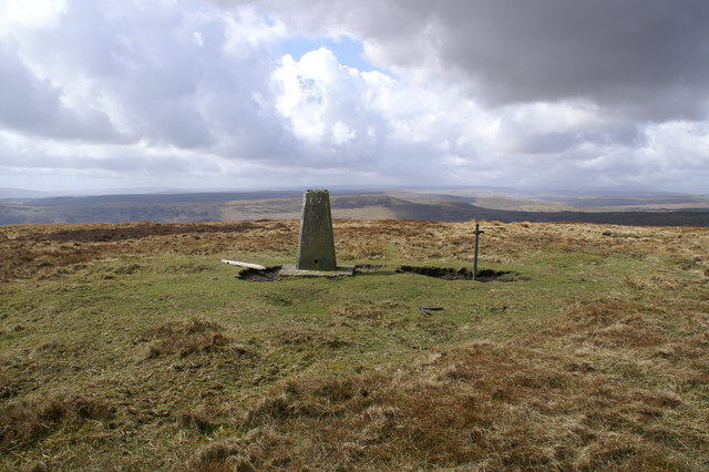
WikipediaMynydd Carn-y-cefn (grid reference SO1808) is the name given to the broad ridge of high ground between the Ebbw Vale and the valley of the Ebbw Fach in the Valleys region of South Wales. It lies within the county borough of Blaenau Gwent, formerly Monmouthshire. The broad-topped ridge runs NNW-SSE and achieves a summit height of 550 metres (1,800 ft) at a point crowned by a trig point at OS grid ref SO 187084 between Ebbw Vale and Blaina. It is a Marilyn with a prominence of 176 metres.
Best months
Hiking score 0–100 · 10-yr climate averagesRows beneath each bar: mean temperature, monthly precipitation. Highest-scoring month in red.
Neighbouring summits
| Name | Elevation | Bearing | Distance |
|---|---|---|---|
| Y Domen Fawr | 504 m | SW 237° | 2.5 km |
| Cefn Manmoel - Y Domen Fawr | 504 m | SW 237° | 2.5 km |
| Briery Hill | 467 m | W 270° | 2.6 km |
| Mulfran | 524 m | NE 37° | 2.7 km |
| Mynydd James | 550 m | E 109° | 2.8 km |
| Darren Ddu | 491 m | S 160° | 2.8 km |