Record SL-434416 · Wikidata Q6803531 · DOBIH 87
Meall Odhar
Graham
HuMP
Simm
TuMP
Marilyn
Elevation
657
m
2,155 ft
Prominence
184 m
Isolation
—
Coordinates
56.4301° N,
4.7617° W
Grid ref
NN297298
Description
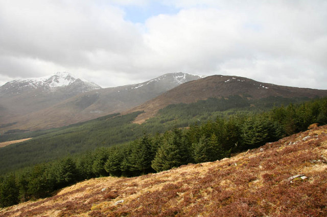
WikipediaMeall Odhar is a mountain in the Scottish Highlands, situated about 3 km to the west of Tyndrum, close to the northern boundary of the Loch Lomond and the Trossachs National Park. Meall Odhar is part of the Tyndrum Hills. With a height of 656 m and a drop of 183 m, it is listed as a Marilyn and a Graham. The name Meall Odhar is from the Gaelic for "dun-coloured round hill".
Best months
Hiking score 0–100 · 10-yr climate averagesRows beneath each bar: mean temperature, monthly precipitation. Highest-scoring month in red.
Neighbouring summits
| Name | Elevation | Bearing | Distance |
|---|---|---|---|
| Drochaid an Droma | 569 m | NE 35° | 0.9 km |
| Sron nan Colan | 590 m | E 70° | 1.4 km |
| Beinn Chuirn | 773 m | W 248° | 1.9 km |
| Beinn Bheag | 653 m | NE 32° | 3.2 km |
| Beinn Dubh | 696 m | W 251° | 3.7 km |
| Beinn Udlaidh | 840 m | NW 330° | 3.8 km |