Record SL-435658 · Wikidata Q814805 · DOBIH 1463
Beinn Bheigier
Ben Vicar
Significant Island Summit
HuMP
TuMP
Marilyn
Elevation
491
m
1,611 ft
Prominence
491 m
Isolation
—
Coordinates
55.7332° N,
6.0954° W
Grid ref
NR429564
Description
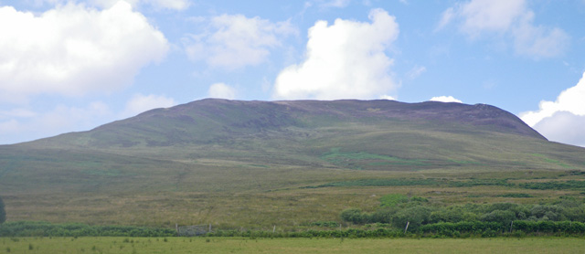
WikipediaBeinn Bheigeir (occasionally anglicised as "Ben Vicar") is a hill on the island of Islay in Scotland. At 491 m, it is the highest of the seven 'Marilyn' hills on Islay, and the highest point on the island. It is in the south east of Islay in the Ardtalla Estate. One possible approach is from Ardtalla: Start by following the path north towards Proaig, then turn west towards Beinn Bheigier. Once some height is gained turn northwest to walk around the hill towards Bealach Corrach. Walk west towards the bealach, then steeply climb up to reach the summit. A trig point marks the summit. On a clear day views include the island of Jura with the Paps of Jura, Kintyre, the Isle of Arran and most of Islay.
Best months
Hiking score 0–100 · 10-yr climate averagesRows beneath each bar: mean temperature, monthly precipitation. Highest-scoring month in red.
Neighbouring summits
| Name | Elevation | Bearing | Distance |
|---|---|---|---|
| Stob Loch nam Breac | 462 m | SW 236° | 2.0 km |
| Beinn Bhan | 472 m | W 263° | 2.7 km |
| Glas Bheinn | 472 m | N 356° | 2.7 km |
| Beinn Uraraidh | 456 m | SW 223° | 3.3 km |
| Beinn na Caillich | 332 m | NE 29° | 3.8 km |
| Sgorr nam Faoileann | 429 m | N 1° | 4.2 km |